We caught the early flight on Saturday morning to Moloka'i
via Lana'i. Jim had made reservations from "Da Kine" car rental or
something like that but they never showed so I ended up renting a car at the airport
terminal from Budget. It was probably a bit more expensive, but very convenient.
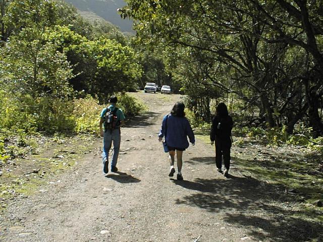
We took a short drive through the misty rain to Moloka'i Mule Stables where we
arranged for our hike down to Kalaupapa along with the included tour.The hike starts a
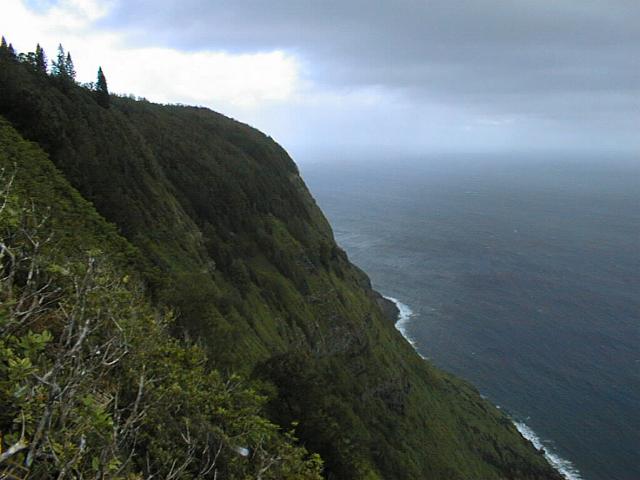
short distance from the stables and heads down the cliffs towards Kalaupapa penninsula.
According to the sign at the end of the trail there are 26 switchbacks covering
just over 3 miles and 1664 vertical feet. Most of the path is made up of roughly
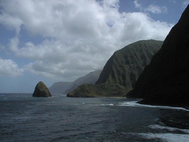
fitted rock steps that make the walk down quite easy. The cliffs that you see on the
left are supposedly the highest sea cliffs in the world! Pretty neat stuff!
Not much native plants that I saw other than a lot of Ala'ala wai'nui growing all
along the sides of the trail. Unfortunately, the dominant tree by far was the
Christmas Berry.
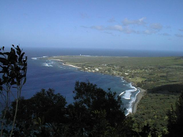
Once reaching the bottom of the switchbacks, we crossed along the beach towards the
Kalaupapa settlement. I wondered how people cross there when the waves are
pumping...
Once on the penninsula, we were greeted by our guide who herded us up in a bus and took
us on the tour of the area (although the day started out overcast with a misty rain, the
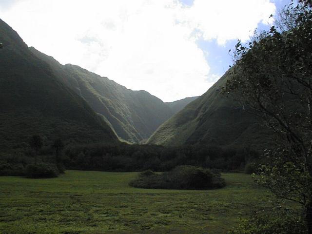
sun was shining brightly by the time we stated our tour). As we headed east, we had
fantastic views of the closer remote north valleys of the island. I decided that
I've got to hike into these valleys sometime during my life! They also treated us to
lunch but I was already a bit full after the delicious <spam-furikake-rice-spam>
musubis that Gail had made! Best I ever tasted!! Even after eating lunch the
climb back went pretty fast and we were up the cliff before we knew it ( I think counting
the switchbacks on the markers made the time go by faster).
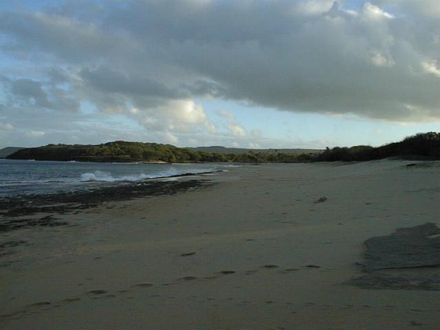
That night I spent by myself on the beach at Kalua Koi Beach Park. Nobody around
for as far as I could see! I fell asleep trying to count the shooting stars and
woke up with the sun. For breakfast I had a powerbar and set off to explore
the many little coves all along that portion of the island. There are so few people
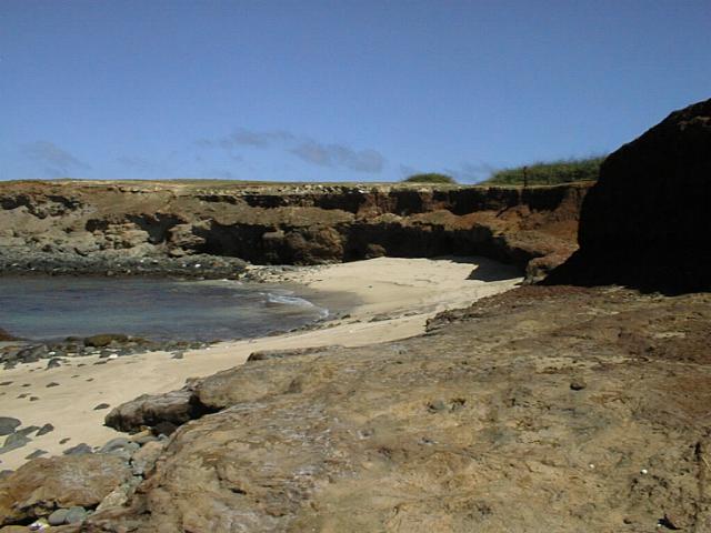
that you can pretty much have a cove to yourself for the whole day! Around noon I
went in search of Mo'omomi Beach Preserve. The map looked like it was a paved road
so I had a pretty hard time finding it. When I finally stopped for directions I
found that you need to take a dirt road a couple miles to the beach to get there. It
was definately worth it! It's so nice to go places where there aren't very many
people and the people who you do meet are all so friendly! Guess that's why it's
"The Friendly Isle". It's definately a place to come back to!

Date: Feburary 6 & 7, 1999
Kalaupapa Time Duration: 7 hours? (hike 1.5 hours each way)
Difficulty: Green
Danger: Green
Although this is an easy hike, it might be a bit difficult to bring the whole family
because it's a little long. Of course they can always have fun riding the mules!
The views are really nice as you walk down the trail and also on the far end of the
penninsula. Although I think you can do the hike for free, you need to sign up for
the tour if you want to actually see all of Kalaupapa and the valleys east of it. To
me those valleys to the east were just incredible!